Kokonga - Dasiybank Car Park 4km
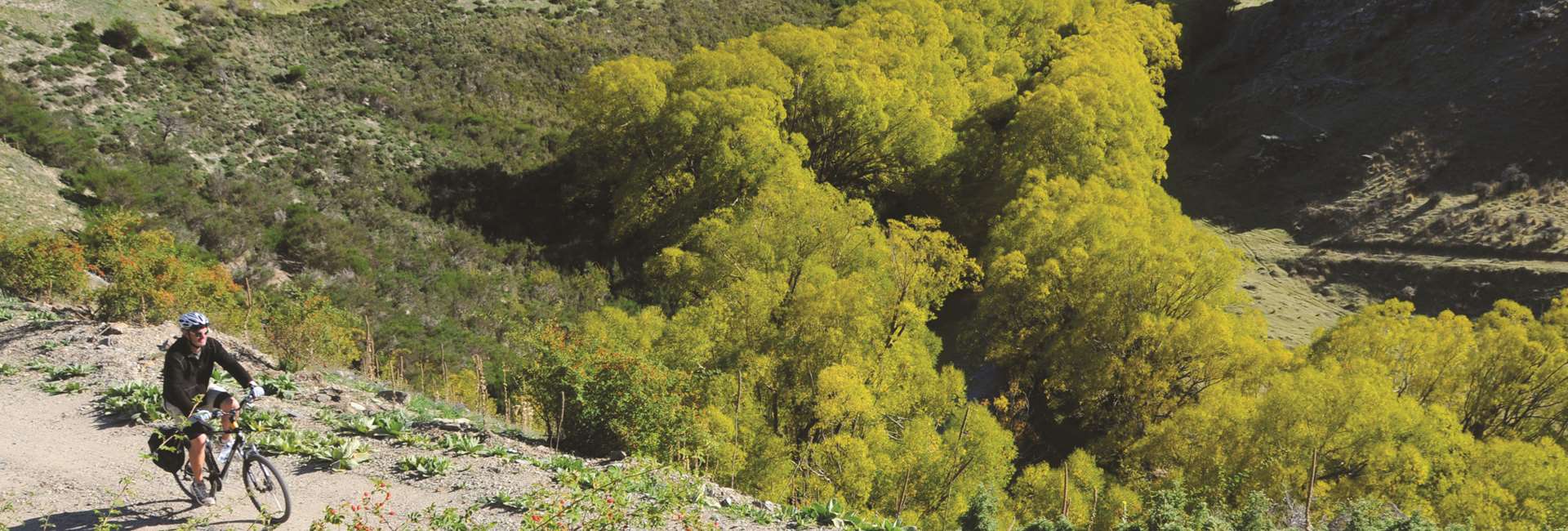
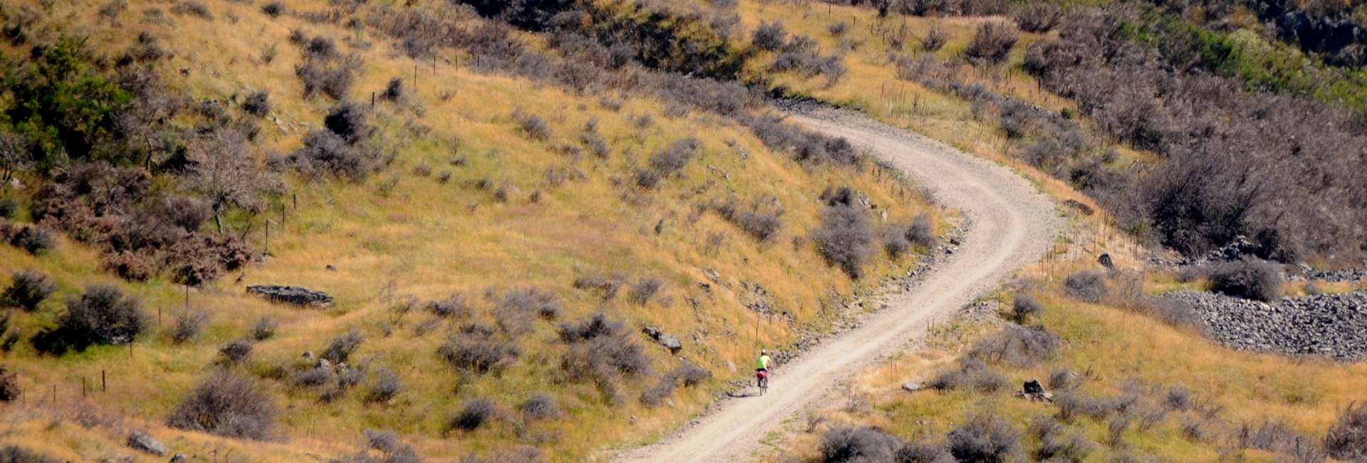
- From Kokonga the Trail runs adjacent to State Highway 87. Take time to admire the impressive Kakanui Mountains to the east.
- The Daisybank car park is another convenient place to meet up with support vehicles. It is clearly signposted on State Highway 87 and on the Rail Trail itself.
Daisy Bank Car Park - Tiroiti 4 km
- Look and also listen carefully for traffic before crossing the sweeping corner of State Highway 87 at Daisybank.
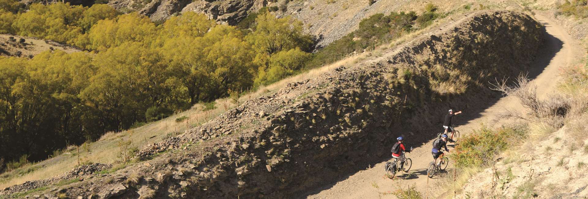
- You are now entering the dramatic terrain of the Upper Taieri Gorge. The many cuts and fills that make the trail easy for cyclists today show just how difficult it was to construct the Otago Central Railway back in the days of the pick, shovel and wheelbarrow.
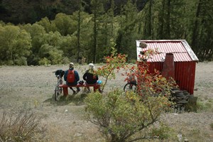
- A remaining feature of the railway’s early days is the Red Dwarf Gangers Shed. Poking your head out of the shed’s little window is a fun photo opportunity.
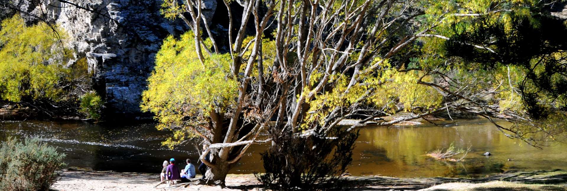
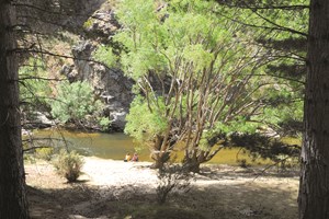
- Not far from here is the Daisybank Freedom Camping site. No open fires are permitted during the closed season. No running water but there is a DOC toilet. Contact DOC for more information. It is recommended hopping off your bike to walk through the pines to the banks of the river at the camping area. Depending on the time of year, take a refreshing plunge in the Taieri.
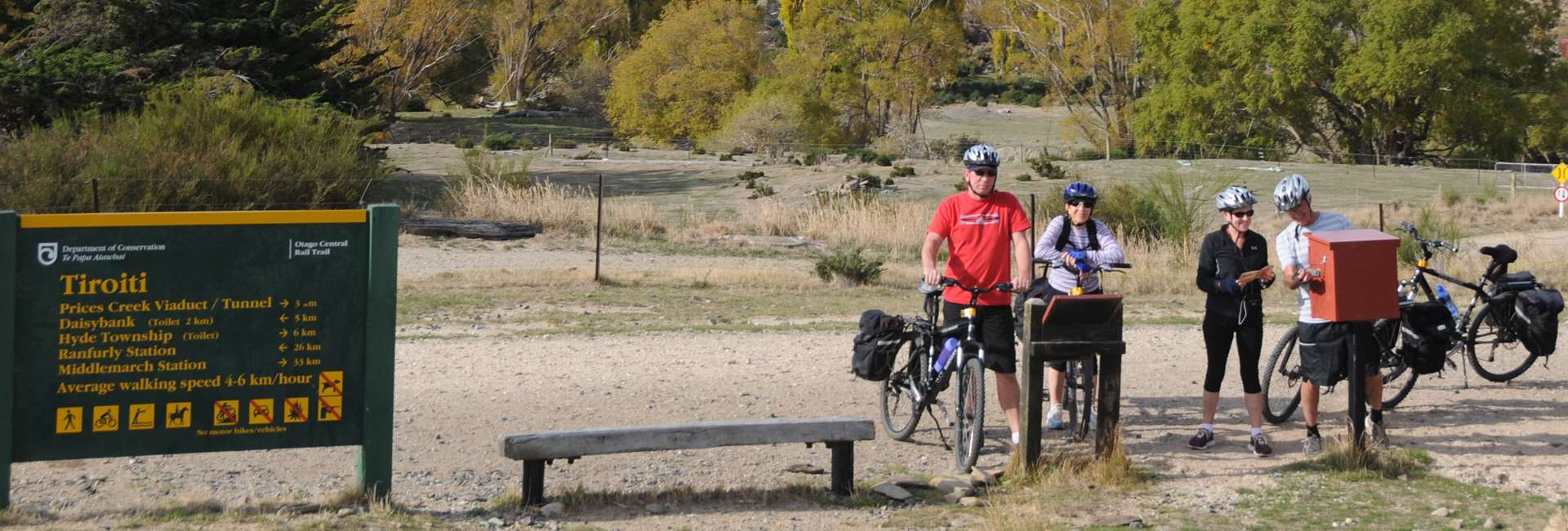
- A couple of km’s later at the Tiroiti station site is a railway red gangers’ shed and information kiosk. Between 1895 and 1897 there was a major railway construction camp at Tiroiti.
Tiroiti - Hyde 6.5 km
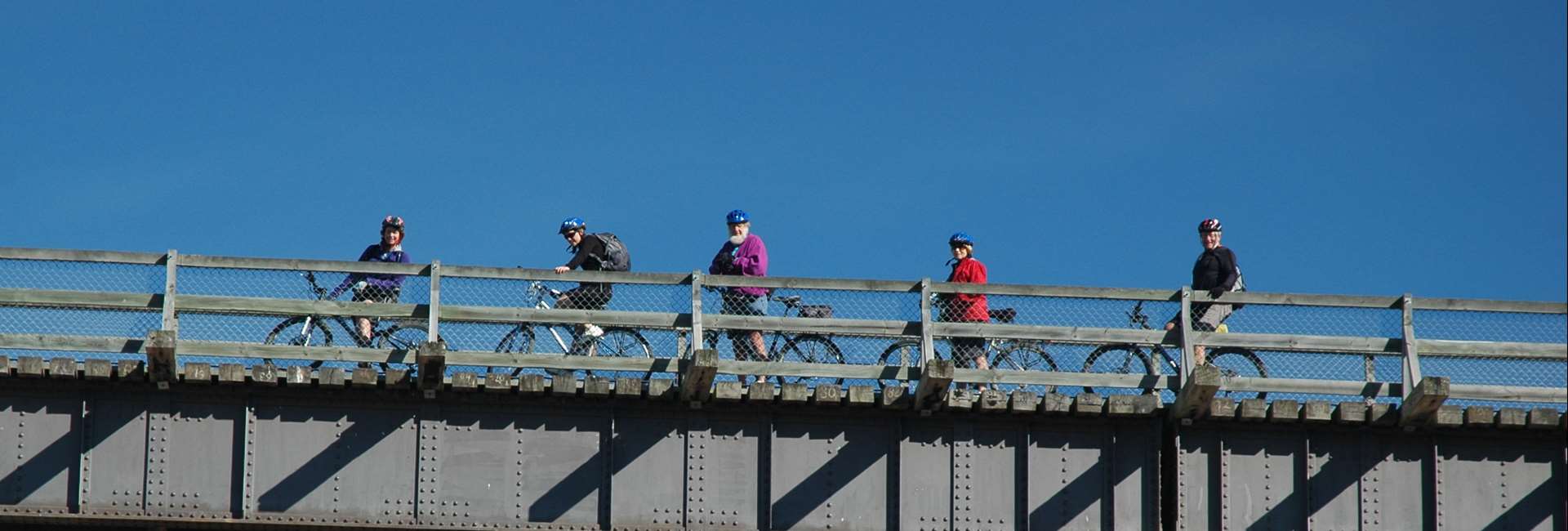
- Not far from Tiroiti is the 40 metres long, 7 metres tall Cap Burn Railway Bridge. We recommend taking time to examine the historic dressed stone abutments and iron trusses as well as the original sleepers and railway lines. .
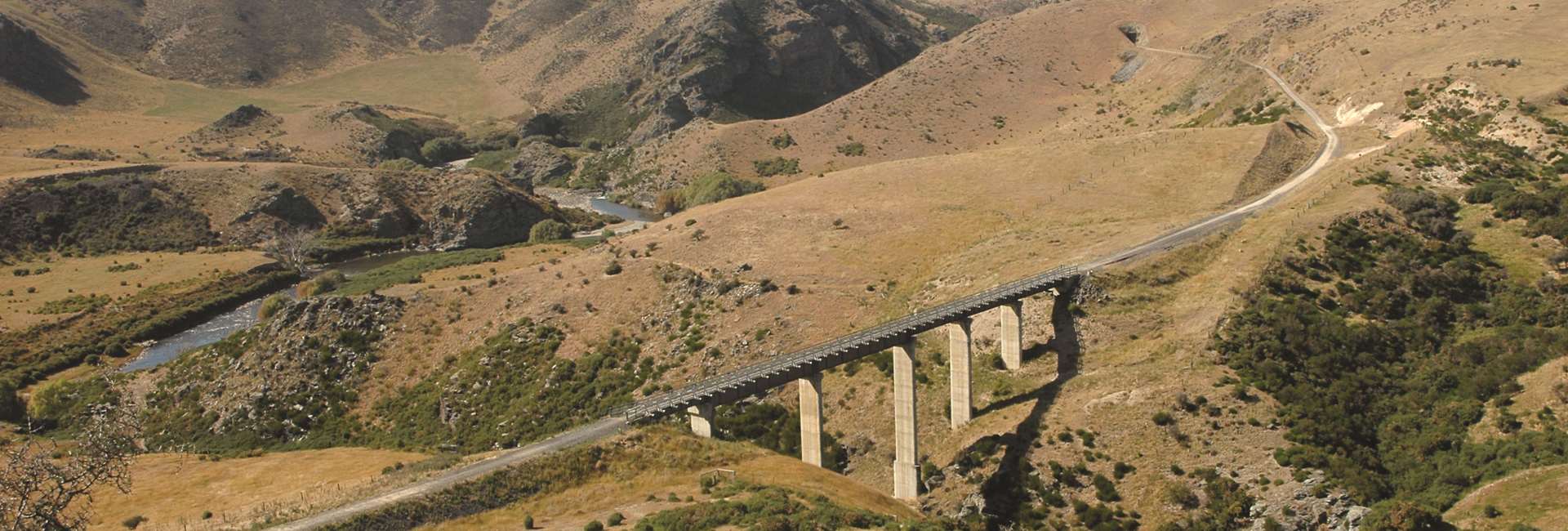
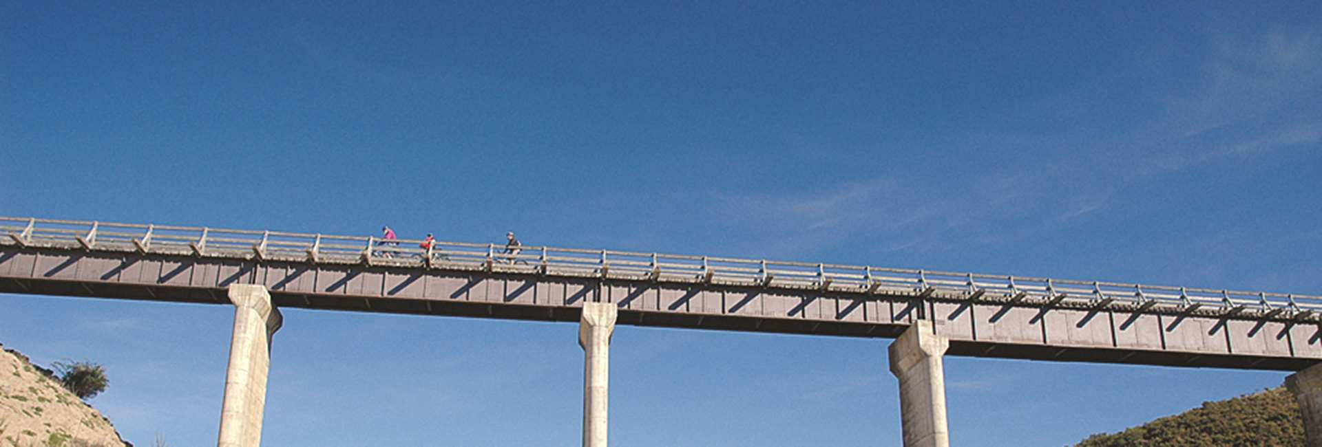
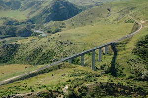
- Next you’ll cross the 91 metres long and 32 metres high Prices Creek Viaduct. Built of concrete and steel in 1963 to replace a wooden bridge, it was the last major construction project before the railway closed. Cyclists should be aware of strong wind gusts when crossing the viaduct.
- An alternative route for horseback riders is signposted on both ends of the viaduct.
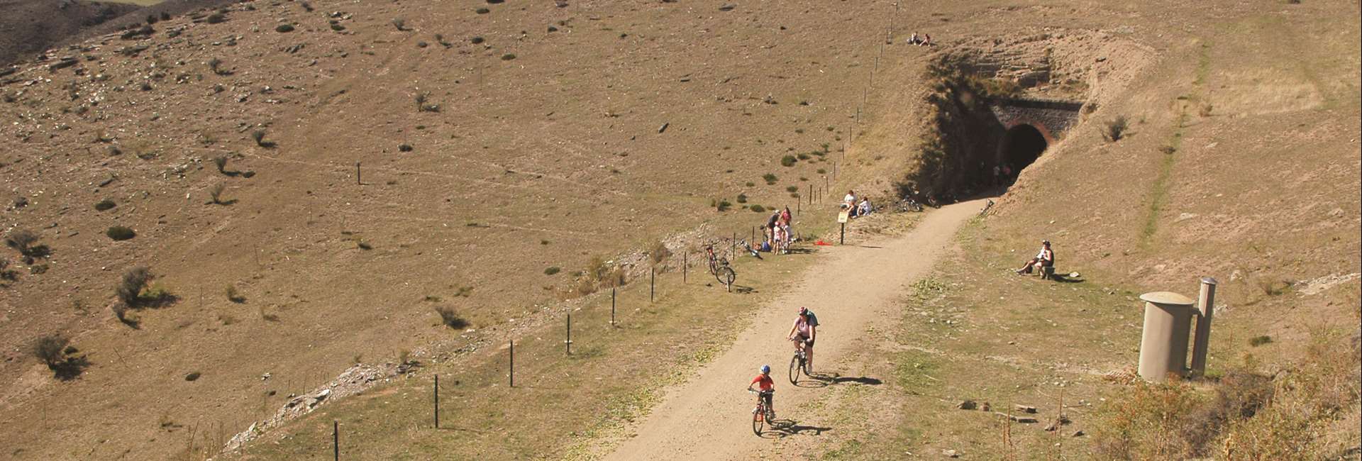
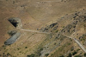
- The attractions keep coming with the 151 metres long slightly curved Prices Creek (Hyde) Tunnel, the only completely bricked tunnel on the Rail Trail.
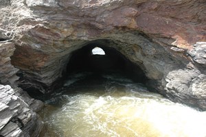
- Close to the tunnel entry a walkway leads down to the Taieri River for a close up view of the Hyde diversion tunnel. By diverting a section of river, miners believed gold could be plucked from the dry river bed. Unfortunately none was found. The walkway offers stunning scenery, interesting history, and great photo opportunities (highly recommended).
- After the Prices Creek (Hyde) Tunnel, a gentle gradient takes you to the township of Hyde where there is a public car park, information kiosk and food and refreshment.
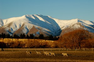
Kakanui Mountains
The impressive Kakanui Mountains to the east.
Red Dwarf Gangers Shed
A remaining feature is the Red Dwarf Gangers Shed with a window to poke you head out of for a photo opportunity.
Daisy Bank Campsite
Cool off with a swim in the Taieri River.
Historic Capburn Railway Bridge
The Capburn Railway Bridge is 40 metres in length and 7 metres in height, still has its original sleepers and railway lines.
Prices Creek Viaduct
The Viaduct is is 91 metres long and 32 metres high, made of steel and concrete construction and is one of the last structures to be built on the Rail Trail.
Hyde Tunnel
The Hyde Tunnel at 151 metres long and slightly curved.
Hyde diversion tunnel
Approaching the Hyde Tunnel there is a new walkway which leads down to the Taieri River to see the Hyde diversion tunnel created for gold mining.
Early European miners peppered the Taieri river with gold and then on sold the mining rights to some Chinese gold miners who were led to believe it was a substantial claim. The Chinese gold miners built a tunnel to divert the river and make it easier to mine the gold. Whilst the diversion tunnel was laboriously and successfully constructed to the Chinese miners dismay the effort was in vain when the “planted” gold ran out shortly afterwards.